Cookie Consent by Free Privacy Policy Generator

Utility Surveys

A utility survey gives you a detailed map of your underground services and the confidence to design, build, and break ground whilst minimising the risk of setbacks.

A utility survey uses specialist equipment to detect and trace buried services such as electricity, gas, water, telecoms and drainage, so you can see what’s beneath your site before work begins.

The results are captured into clear survey drawings (typically CAD/PDF), giving your team a reliable reference for planning excavations, avoiding clashes in the design stage, and reducing the chance of costly delays caused by unknown or mislocated utilities.

  • Reduce the risk of utility strikes by identifying buried services before excavation, drilling or piling.
  • Avoid costly redesigns and delays by spotting underground constraints early in the planning stage.
  • Improve site safety and compliance with clearer information for RAMS, permits to dig, and on-site decision-making.
  • Make faster, more confident decisions with clear survey outputs your designers and groundworks team can use immediately.
5.0
powered by Google
Call us today
+44(0)143 884 1300

Get a free quote

Request a free, no-obligation quote for your project today.

Max. 5MB images, .dwg, .dxf, .docx, or .pdf files only.

When You Need A Utility Survey

Utility surveys are typically needed at two key stages: early in a project to map services across the site, and right before excavation to reduce the risk of a utility strike.

    Type D Desktop utility record search

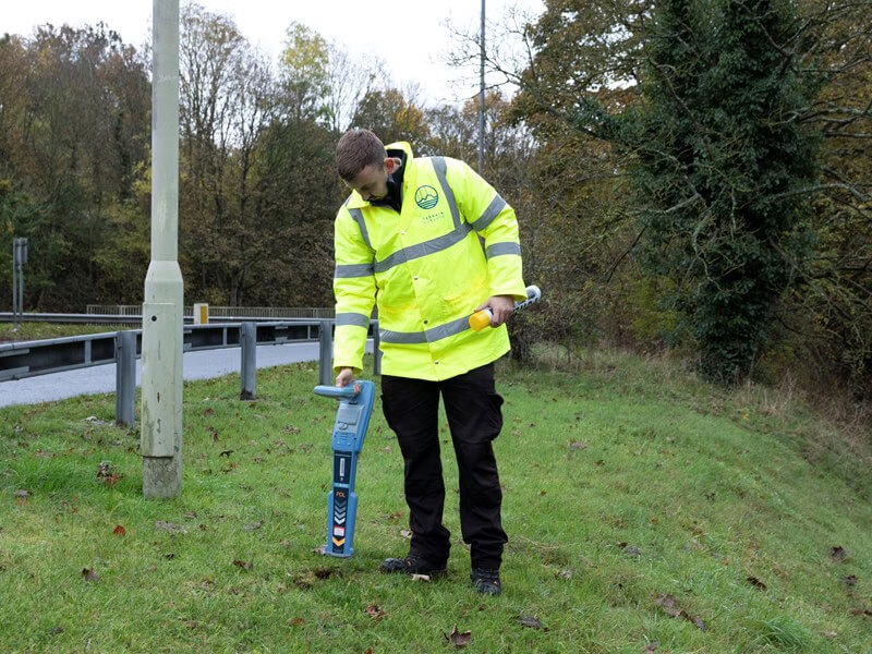
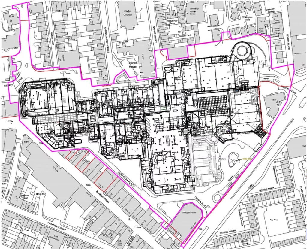
    Utility Mapping Surveys

    If you’re planning, designing or pricing works, a site-wide utility survey gives you a clear picture of what’s underground across the full area. This helps you avoid design clashes, plan routes for foundations and drainage, and reduce expensive last-minute changes once works are underway.

    Read More
    Type B Detection

    Utility Clearance Surveys

    If you’re about to dig, drill, trench or pile, a pre-excavation clearance survey focuses on the specific work zone so you can break ground with greater confidence. By identifying utilities where you’re working, it helps you reduce strike risk, minimise delays, and keep teams safer on site.

    Read More

PAS 128 Compliance: The Gold Standard

Our utility surveys are delivered in line with PAS 128 — the UK specification for underground utility detection and mapping. This gives you a clear, consistent standard for survey method and reporting, helping you make safer decisions, reduce risk, and demonstrate due diligence on site.

Learn More About PAS 128

    What’s Included in a Utility survey?

    A utility survey helps you understand what’s running beneath your site before you design, excavate or drill. Using a combination of electromagnetic locating (EML) and ground penetrating radar (GPR) (and where possible, information from existing utility records), we locate and map buried services so you can plan works with greater confidence and reduce the risk of strikes, delays, and of course costly redesigns.

    Typical utilities we locate include:
    • Electricity cables (LV/HV where detectable), including street lighting and private power feeds
    • Telecommunications and data services (including fibre routes)
    • Gas mains and services
    • Water mains and supply pipes
    • Drainage routes and associated structures e.g. chambers and manholes
    • Heating / thermal networks where present and detectable
    Request free quote

Our Technology

To get a clear idea of what's beneath the surface, we deploy cutting-edge technologies such as EML and GPR to do a type of ultrasound of the ground. Used together, they give a fuller picture of what’s underground and increase the reliability of the survey.

    Gpr Surveys Slider 3

    EML (Electromagnetic Location)

    EML is excellent for tracing metallic pipes and live cables. We also use sondes to trace non-metallic drains when access is available.

    Read More
    Gpr Surveys Slider 2

    GPR (Ground Penetrating Radar)

    GPR detects anomalies in the ground which allows us to locate both metallic and non-metallic features— including plastic pipes and ducts as well as providing an estimation of depth.

    Read More
    Topographical Utility And Measured Building Surveys (1)

    What We'll deliver

    You’ll receive clear, usable outputs that help you design safely, plan works confidently.
    • Utility plan (CAD + PDF): a clean map of detected services across your survey area, ready to share with designers and site teams.
    • Depth & confidence info: so you know what’s reliable, what’s uncertain, and where extra caution or verification may be needed.
    • Findings summary: key constraints, risk areas, and practical recommendations to keep your project moving.
    • Optional on-site marking (pre-excavation): services marked on the ground in the work zone to support safer digging.
    • Topo survey integration: If you need a utility survey and a topographic survey, we can handle both, ensuring the underground utilities are overlayed onto the topographical survey map.
    Get a fixed quote today

Accreditations

6 key reasons to choose Terrain Surveys

Why us

  • Experienced

    Established in 2004 by three founding directors determined to improve surveying standards, Terrain Surveys Ltd was created with a commitment to excellence.
  • Highly rated

    Terrain Surveys strives to be the survey company of choice through a wide scope of knowledge and a constant drive for excellence. We pride ourselves on the quality of service provided, including customer service, survey deliverables, training, education, and the systems we operate.
  • Focus on sustainability

    As a leading provider of measured survey services, Terrain Surveys understands the critical role our work plays in shaping the built environment. We are committed to integrating sustainable practices into every aspect of our operations.
  • Qualified and accredited

    Terrain Surveys Ltd holds the ISO 9001:2015 accreditation, reflecting our commitment to quality management systems and consistent service delivery. Additionally, our team includes professionals with various industry-specific qualifications and certifications, such as membership in the Royal Institution of Chartered Surveyors (RICS) and the Chartered Institution of Civil Engineering Surveyors (CICES).
  • Diverse and growing team

    Our strength lies in our team, whose experience and knowledge, coupled with investment in training and technology, enable efficient work and the production of high-quality, accurate measured surveys that meet clients' strict deadlines.
  • Nationwide coverage

    Terrain Surveys provides comprehensive national coverage across the UK, ensuring clients receive consistent, high-quality surveying services wherever they are. With strategically located offices, the company is well-positioned to deliver efficient and tailored solutions to meet a variety of client needs.

Our work

From our main offices in Hertfordshire and Birmingham, we've carried out thousands of utility surveys across the UK. Browse our project case studies below or get in touch with our team to discover how we can help you.

What customers say about Terrain Surveys

Reviews

Eddie profile picture
Eddie
14:51 08 Aug 24
Terrain Surveys Ltd have carried out a first class service of locating a drain pipe under my garden. Particular praise must go to Gareth and Euan, the onsite operatives who performed a first class survey on an extremely hot day. Consideration and care was exercised in my and my neighbours garden. Praise must also go to Sue in the office. All requests and questions were quickly responded to. Thank you.
Tye A. profile picture
Tye A.
23:28 28 May 24
Terrain Surveys have provided consistently high quality digital surveys for us for over a decade and we continue to use them through our work all over the UK - highly recommended
Mark S. profile picture
Mark S.
15:03 15 Mar 24
Always complete the works to an excellent level, on time and as quoted.
Amethyst S. profile picture
Amethyst S.
13:32 27 Apr 23
We have been working with Terrain surveys for more than 15 years. Terrain provide us with Topographic Surveys, Measured Building Surveys, 3D Revit Models and BIM, to an extremely high standard. They always provide excellent service and guidance throughout the entire process, and I would highly recommend their services.
Josh R. profile picture
Josh R.
11:22 27 Mar 19
Great surveys at competitive prices. Have used on two large jobs now and work has always been completed on time with the detail required. Recommended.
Shiraz K. profile picture
Shiraz K.
10:54 09 May 18
I gained quotes from 5 different surveyors for the same job, terrain came £700 cheaper then competitors.

We'd love to hear from you

Get a free quote ONLINE OR CALL

+44(0)143 884 1300

Request a free, no-obligation quote for your project today.

Max. 5MB images, .dwg, .dxf, .docx, or .pdf files only.

Processing...
Thank you! Your subscription has been confirmed. You'll hear from us soon.
ErrorHere