
3D Laser Scanning
3D Laser Scanning, or High Definition Surveying is a highly effective surveying method for the most intricate of spaces that are difficult…

3D Laser Scanning, or High Definition Surveying is a highly effective surveying method for the most intricate of spaces that are difficult…

A comprehensive 3D survey model is essential for your Building Information Modelling (BIM) project.

Area measurement surveys or Area Referencing Surveys are often required for a number of reasons including for valuation purposes, management, taxation, sale…

From standard connectivity/condition to pre and post rehabilitation, as well as the identification of ongoing issues, Terrain Surveys are proud to undertake…
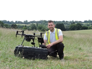
Drone surveys can provide a powerful alternative to traditional ground-based surveying. They allow us to cover large or complex sites rapidly, reach…

Ground Penetrating Radar (GPR) is a technique used in conjunction with Electromagnetic locators to carry out underground utility surveys

From Floor Plans to Elevations and Sections, Terrain Surveys have delivered thousands of Measured Building Surveys over two decades. We undertake Measured…

A Monitoring Survey measures small movements within a structure or building either where a movement issue is already identified or to monitor…

A PAS128 Survey is an underground utility survey which detects, verifies, and locates all underground utilities.
A measured survey for Rights of light is necessary to enable specialists to analyse the impact on existing buildings from a proposed…

Topographical Surveys are essential for a vast array of construction, renovation, engineering and land management projects.

A utility clearance survey is an essential step in avoiding accidental strikes on buried service infrastructure when undertaking excavation or drilling works.

A Utility Survey is a below surface survey identifying all underground utilities and service routes including gas, water, telecommunications, electricity and drainage,…
Get in touch
If you would like to discuss a project please contact our team


